Orland Industrial Park
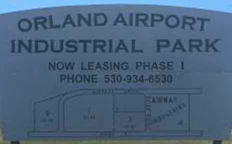 The 65-acre Orland Airport Industrial Park is a premium site that provides the edge your business needs to meet your relocation, expansion or startup goals.
With parcels ranging from three to 18 acres and zoned MP Industrial Park or MP District, the park is intended to feature well-designed buildings and attractively landscaped areas.
The Park’s central location is only 3.5 miles east of Interstate-5, with excellent access to major markets and urban areas like:
- Redding, California – 65 miles
- Sacramento, California – 98 miles
- San Francisco, California – 154 miles
- Los Angeles, California – 480 miles
- Seattle, Washington – 655 miles
Information
Location and Directions
The Orland Airport Industrial Park is located less than one mile southeast of the City of Orland and approximately 3.5 miles east of Interstate-5 and 1.5 miles south of State Highway 32. Specifically, it is located north of County Road 24, on the south side of County Road 200, on the west side of County Road P, on the east side of the Orland Haigh Field Airport and Airpark Drive; in the unincorporated area of Glenn County, California. It consists of portions of Sections 25 and 36, T22N, R3W, M.D.B. & M.
Directions
Getting to the Orland Airport Industrial Park is convenient and fast.
Northbound Interstate-5 To Orland Airport Industrial Park
From Interstate-5, exit on to the County Road 27 off-ramp (Exit #614) and travel east for approximately 3.3 miles to the intersection with County Road P. Head north on County Road P for approximately 2.0 miles to the intersection with County Road 24. Continue on traveling north on County Road P for approximately 0.25 miles; the Orland Airport Industrial Park is located on the west side of the road.
Southbound Interstate-5 To Orland Airport Industrial Park
From Interstate-5, exit on to the County Road 16/South Street off-ramp (Exit #618) and travel east for approximately 1.5 miles to the intersection with County Road M, Papst Avenue, and County Road 200. Then head southeast on County Road 200 for approximately 2.2 miles to the intersection with County Road P and County Road 20; the Orland Airport Industrial Park is located just southwest of this intersection.
East/Westbound State Highway 32 To Orland Airport Industrial Park
From State Highway 32, turn onto County Road P heading south for approximately 1.5 miles to the intersection with County Road 200 and County Road 20; the Orland Airport Industrial Park is located just southwest of this intersection.
Proximity to Major Roads
Interstate-5
The Orland Airport Industrial Park is located approximately 3.5 miles east of Interstate-5. Interstate-5 is the major north-south road in Glenn County, which provides the connection between Glenn County and cities to the north, such as Red Bluff and Redding, and to the south such as Sacramento.
County Road 99W
County Road 99W (originally Highway 99W) is parallel to and east of Interstate 5, passing through Willows, Artois, and Orland and serves a significant percentage of traffic between these areas.
State Highway 32
The Orland Airport Industrial Park is located approximately 1.5 miles south of State Highway 32. State Highway 32 is a major east-west road in Glenn County, which provides the connection between Glenn County and Butte County. This route extends approximately 11 miles east from Interstate 5 through Orland and Hamilton City to the Butte County border. From the Butte County border, it extends approximately 11 miles to the City of Chico, which is the largest urban area in the region.
Lot Information and Internal Circulation
Lot Information
| Parcel No. | Assessor No. | Square Footage | Acres | Phase |
|---|---|---|---|---|
| 1 | 047-270-017-0 | 397,702.8 | 9.13 | I |
| 2 | 047-270-015-0 | 131,115.6 | 3.01 | I |
| 3 | 047-270-016-0 | 130,680.0 | 3.00 | I |
| 4 | 047-180-007-0 | 304,920.0 | 7.00 | I |
| 5 | 047-180-011-0 | 217,800.0 | 5.00 | II |
| 6 | 047-180-010-0 | 171,190.8 | 3.93 | II |
| 7 | 047-180-009-0 | 789,307.2 | 18.12 | II |
| 8 | 047-090-056-0 | 493,099.2 | 11.32 | II |
| 9 | 047-270-010-9 | 168,141.6 | 3.86 | I |
The Orland Airport Industrial Park currently consists of nine (9) different parcels that are available for non-aeronautical use. The total area of the parcels is approximately 64.37 acres. An appraisal completed in May of 2004 by Evans Appraisal Service estimated the market value of these parcels at $2,944,000. Each parcel is zoned “MP-Industrial Park or MP District” and has a General Plan land use designation of “Business Park”. Please see MP Industrial Park or MP District for a complete copy of the zoning regulations. The size of a parcel can be adjusted by the County to meet the needs of a business.
Phase I of the Orland Airport Industrial Park is available for lease. Phase I consists of parcels 1 through 4 as well as parcel 9. Phase I has been developed with paved streets which include curbs, gutters, storm drainage improvements, street lights, and fire hydrants. There is access to utilities including sewer, water, power, and communication facilities.
Infrastructure for Phase II has not been developed.
Existing Uses and Structures
Parcel 4 currently consists of a 100,800 square foot industrial distribution warehouse. This building is currently for sale. You may go to the following link to find out more information about this site and building.
Parcel 2 is currently leased to Flowserve Corporation. Flowserve Corporation is the recognized world leader in supplying pumps, valves, seals automation and services to the power, oil, gas, chemical and other industries. They have more than 14,000 employees in more than 56 countries. Flowserve Corporation has an existing 16,800 square foot building. The building improvements consist of a steel-framed, single tenant industrial building. The building has a concrete slab foundation, an insulated ceiling with skylights, and fluorescent lighting. There is also a 4,320± square foot metal building which houses pipe and plate used in the manufacturing of pumps.
Internal Circulation within the Orland Airport Industrial Park
Airpark Drive runs along the west side of the industrial park and provides access to the west side. The Phase I portion (parcels 1-4, and 9) of this road is currently completed. The Phase I portion of the road extends from County Road P and provides access to Parcels 1, 2, 4, and 9. The Phase II portion (parcels 5-8) of this road will continue along the west side of the industrial park and will terminate at County Road 200. The Phase II portion of this road will provide access to Parcels 5, 6, 7, and 8.
Haigh Drive runs east to west within the industrial park and provides a route between County Road P and Airpark Drive. This road provides frontage along Parcels 2, 3, and 4. This road has been completed as it is a part of Phase I of the industrial park. Similarly, County Road 21 will run east to west within the industrial park and will provide a route between County Road P and Airpark Drive. This road has not been completed as it is a part of Phase II of the industrial park. This road will supply frontage to Parcels 6 and 7.
Potential Site Layouts for Phase I
During the 2003-2004 fiscal year, the County of Glenn applied for and received approval for a Community Development Block Grant (CDBG) Planning and Technical Assistance (PTA) grant.
One of the objectives of the Glenn Airport Management Plan, Phase II, Grant # 03-PTAA-0039 was to complete a market assessment for the non-aeronautical use of airport property to evaluate the market and identify the various types of uses the County could attract to available non-aeronautical airport property.
The County of Glenn retained the Tri-County Economic Development Corporation (TCEDC) through a sub-recipient agreement to complete the scope of work.
Through a request for proposal process, TCEDC procured the services of Russell, Gallaway Associates, Inc. (RGA) to complete architectural services which included the development of schematic site plans showing potential building locations and parking and landscaping layouts.
Click on the following links to view the schematic layouts for each of the parcels:
- Schematic Layout (Sheet SP-1) - Parcels 1, 3, and 9
- Schematic Layout (Sheet SP-2) - Parcels 1 only
- Schematic Layout (Sheet SP-3) - Parcels 3 and 9 only
As noted in Sheet SP-1, the layout configuration yields 261,360 square feet of building space spread over 5 buildings. The building sizes range from 43,067 square feet to 67,944 square feet spread over the 15.99 acre area. A typical floor to area (FAR) ratio is 40%, which represents the building area divided by the total land area. The Phase I project area has a FAR of 37.5%, comparing favorably to the typical FAR ratio.
Permitted Uses
All parcels within the Orland Airport Industrial Park are zoned MP Industrial Park or MP District. This zone is described under Chapter 15.510 of the Glenn County Code. Chapter 15.510 defines the permitted uses and conditionally permitted uses.
There are a total of fourteen permitted heavy commercial and manufacturing uses and a total of four conditionally permitted heavy commercial and manufacturing uses. Chapter 15.510 also defines development standards such as minimum lot size, minimum yards (setbacks), maximum height, and additional performance standards.
New development proposals for uses outlined under Section 15.510.030 of the Glenn County Code will require approval of a Site Plan Review prior to the issuance of a building permit. This requirement is outlined under Section 15.510.120 of the Glenn County Code. Other development proposals for uses outlined under Section 15.510.040 of the Glenn County Code will require approval of a Conditional Use Permit by the Planning Commission.
The Orland Airport Industrial Park also has design standards which are in addition to zoning regulations.
Relevant Documents: